
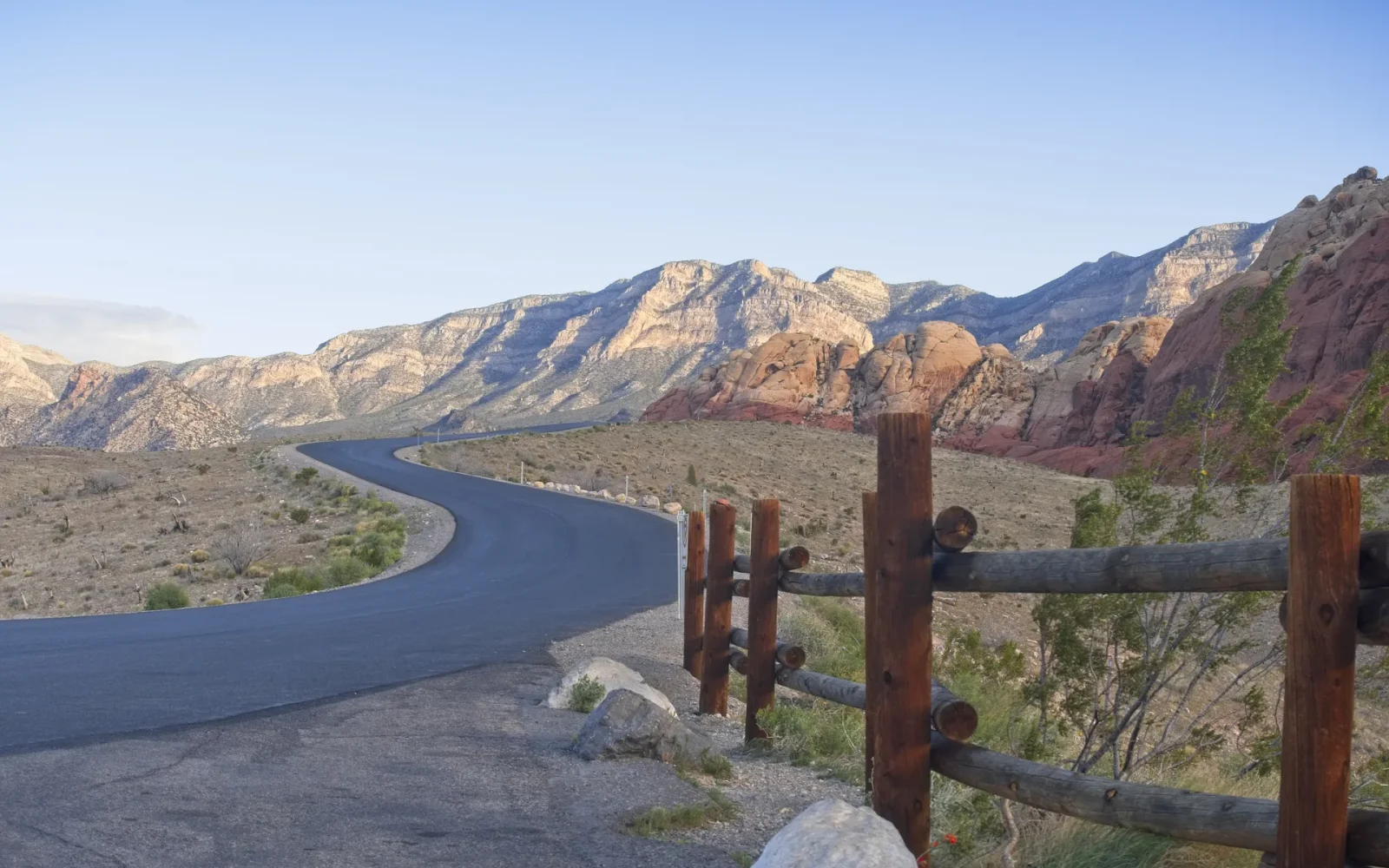
Las Vegas makes more sense when you can see its edges. West of the city, the walls and folds of Red Rock Canyon National Conservation Area rise above a broad Mojave basin. The contrast is immediate: a dense entertainment corridor occupies one part of a much larger valley shaped by dry washes, mountain fronts, desert plants, and hard-changing light. A Red Rock outing is therefore more than an escape from the city. It is a useful way to understand where the city sits.
Read the landscape before choosing a route
Red Rock is known for warm sandstone, pale limestone, and the dramatic evidence of geological pressure. Around the Calico Hills, iron-bearing sandstone produces orange and red surfaces that deepen or flatten as the sun moves. Elsewhere, gray limestone and layered ridges create a cooler, more severe backdrop. The Keystone Thrust is an especially visible lesson in deep time, where older limestone was pushed over younger rock during a long period of mountain building.
You do not need specialist knowledge to notice the changes. Look for horizontal bands, tilted layers, dark desert varnish, pockets of vegetation, and the sharp line between sun and shadow. Those details are often more revealing than a single panoramic photograph. They also explain why a viewpoint that feels quiet in one direction can still reveal the Las Vegas Valley in another.
Match the experience to your group
The conservation area supports several kinds of visit, from scenic overlooks and short interpretive stops to longer hikes that demand route-finding, fitness, and weather awareness. Choose according to the least experienced person in the group, not the most ambitious plan. Official Bureau of Land Management information is the right place to confirm current access rules, seasonal conditions, reservation requirements, closures, and trail guidance before leaving the city.
- Choose an overlook-focused visit when time, mobility, or heat makes a long walk unsuitable.
- Choose a short trail when everyone has stable footwear, water, sun protection, and a clear turnaround point.
- Choose a longer backcountry route only with current maps, realistic timing, and experience appropriate to the terrain.
Plan for a dry landscape, not a vacant one
The Mojave can look spare from a distance, but it is a living environment. Creosote, yucca, cacti, small mammals, reptiles, birds, and seasonal wildflowers occupy specific niches. Stay on durable or designated surfaces, give wildlife space, and leave rocks, plants, and cultural material where they are. A dry wash can also carry sudden water after rain falls elsewhere, so clear skies overhead do not replace a weather check.
Heat is only one variable. Wind can make exposed areas uncomfortable, winter conditions can affect higher ground, and rock surfaces can become slick or unstable. Carry more drinking water than an ordinary city walk would require, and do not assume that a short map distance means an easy outing. Mobile service can be inconsistent near cliffs and canyons. Tell someone your plan when heading beyond busy viewpoints.
Notice how the light changes the place
Red Rock rewards observation at several scales. Lower light can reveal texture in the sandstone, while strong midday sun makes the geometry of cliffs and shadows unusually clear. Cloud cover can mute the famous red and bring forward green-gray vegetation and pale stone. Rather than chasing a permanent sunset image, allow the actual conditions to set the visual character of the visit.
For photographs, keep a recognizable junction, plant, or person in the frame to communicate scale. Avoid stepping onto fragile soil or blocking a trail for a shot. If photographing other visitors, climbers, or staff closely enough to identify them, ask permission. The landscape is compelling without turning someone else’s activity into an uncredited backdrop.
Connect Red Rock to the wider valley
The conservation area is one part of a larger system. The Spring Mountains define the valley’s western horizon. Springs Preserve interprets the water, ecology, and human history that preceded the modern resort city. Las Vegas Wash carries water toward Lake Mead, while Hoover Dam and its infrastructure tell another chapter about regional growth and the Colorado River. These places should not be compressed into one hurried checklist, but understanding their relationship changes how the city appears.
A balanced day might pair one focused outdoor experience with a later neighborhood meal, gallery visit, or performance rather than treating the desert as a brief photo stop between attractions. Build in time to return, clean up, hydrate, and shift pace. Desert dust and quiet can sharpen your attention to Downtown masonry, sign metal, planted shade, and the labor behind a finished stage.
Still comparing Red Rock And The Valley: Reading The Mojave Edge Of Las Vegas?
Ask for tour ideas, hotel suggestions, or a simple trip plan that combines both.
Trip Helper
Return with a better mental map
From the valley floor, Las Vegas often feels endless. From Red Rock, its limits become legible. Roads, buildings, and lights occupy a basin bounded by landforms that were here long before the city and will outlast its latest reinvention. That perspective does not diminish the spectacle. It gives it proportion.
Before visiting, use current official sources for access and safety details, carry out everything you bring in, and adapt the plan when conditions change. The most useful Red Rock experience is not the one with the longest trail or most dramatic photograph. It is the one that leaves both the landscape and your group in good condition, then sends you back into Las Vegas able to see the city within its Mojave setting.